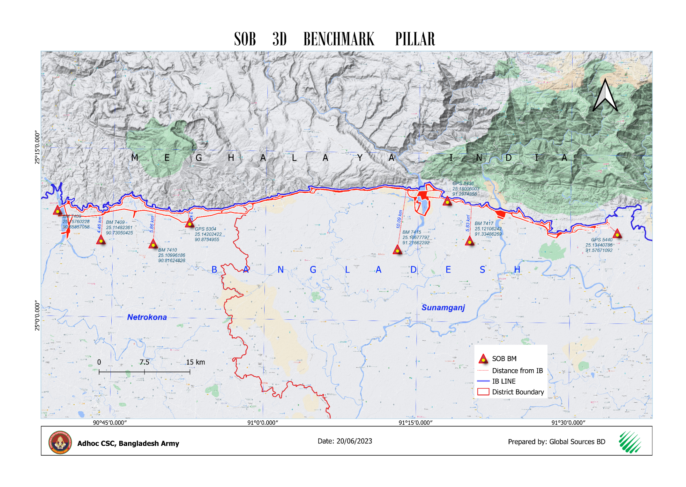
SERVICES WE OFFER
Global Sources BD is committed to fulfilling its clients' expectations via excellent service, innovation, and management. To accomplish this commitment, the firm is dedicated to support the activities of cadastral mapping, planning, development, and feasibility study, with the application of geographic information systems (GIS) and remote sensing (RS) techniques, databases, information technology, and other modern technology outfits.

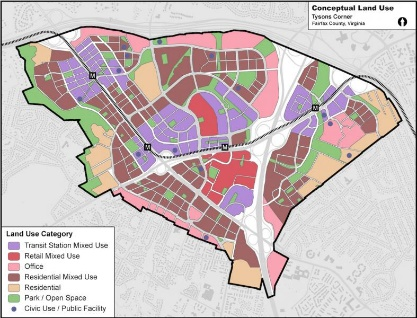
URBAN PLANNING
Land Use Planning Transportation Planning Infrastructure Development Housing and Community Development Public Engagement Policy and Regulation Environmental Sustainability
FEASIBILITY STUDY
Mouza sheet Alignment Environmental Impact Assessment (EIA) Traffic Study and Forecasting Analysis Technical Assessment Socio-economic profiling and resettlement planning Financial Analysis
LAND PLANNING SERVICES
Master Planning Mixed Land Use Planning Site Analysis and Schematic Designs Rural Subdivision Planning and Design Landscape Planning and Design
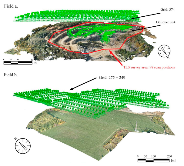
UAV MAPPING & SURVEYING
Aerial Topographic Surveys Orthophoto Generation 3D Terrain Modeling Infrastructure Inspection & Mapping Environmental & Forestry Surveys

HYDROLOGICAL SURVEY & ANALYSIS
Delineation of Watersheds Flow Modeling Flow Measurement Water Quality Sampling Floodplain Mapping Flood Frequency Analysis

SOCIO-ECONOMIC SURVEY
Community Profiling Livelihood & Employment Assessments Social Impact Assessments (SIA) Stakeholder Engagement & Focus Group Discussions Data Collection & Analysis Using Digital Tools Public Perception & Satisfaction Surveys
GIS Analysis, Mapping
Cadastral Mapping Aerial Based Historical Maps (replicas) Location Analysis Attribute Analysis

CADASTRAL SURVEY & SOLUTION
Boundary Measurement and Markingg Corner Points and Monuments Global Navigation Satellite Systems (GNSS) Total Station & RTK Leveling Instruments Land Records